Panpatiya Snowfield – The Lost Trail
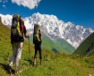
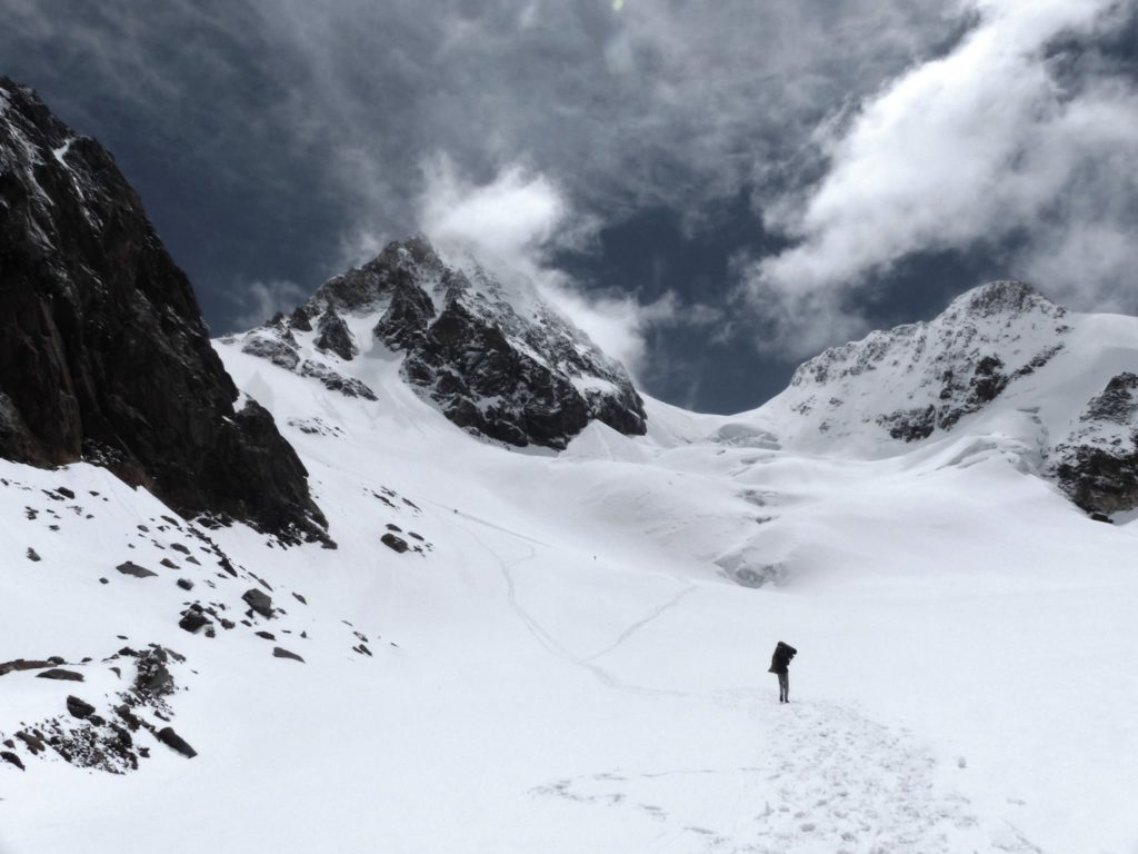
Panpatia Col is a snow lamented belt. It is one of the most challenging treks in the Garhwal region of Himalayas, Uttarakhand. Panpatia glacier reigns at an impressive altitude of 17,257 ft and marries two of India’s most anticipated pilgrimage sites, Kedarnath and Badrinath.
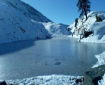
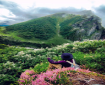
This route is one of the tallest passes in the Himalayas therefore it is tough and is not fit for novice trekkers. The trail takes you through massive glaciers, crevassed snowfields, rocky moraines, and therefore the never-ending 7km long Panpatia snowfield which may be a treat for aspirational trekkers looking to tick challenging treks off their bucket list. During the daytime, the temperature ranges between 15 to 20 degrees, while nights get very cold with temperatures dropping to -5 to 10 degrees. Connecting two of the holy shrines of Hindu – Badrinath and Kedarnath, a mythological story has it that a sage used to perform rituals in both the temples on the same day using this route known as Kedar Badri. This created enough crest amongst the mountaineers and explorers to find a route connecting the two shrines of Kedarnath and Badrinath.
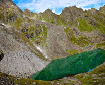
The Panpatia Col Trek gives you unparalleled views of prominent peaks like Chaukhamba, Nilkantha, Balakun, Hathi Parvat, and Dhauliganga Peaks.
You will be required to stay at very high altitudes over lengthy periods of time and therefore acclimatization can be a big concern. You are also in for a bit of a surprise, largely because of the peculiar nature of the terrain and the snow conditions. Forests to remote places completely cut out from human civilization this is not for the faint-hearted. Would you dare to attempt this?
| Duration: | 16 Days, Rishikesh to Rishikesh |
| Altitude: | 17257 ft |
| Grade: | Difficult |
| Best Time: | September to November |
| Terrain: | Forest, alpine meadows, rocky, snow field |
| Start Point: | Hanumanchati |
| End Point: | Ransi |
Itinerary
Day 1.
Arrival at Rishikesh. Overnight in Hotel.
Day 2.
Drive from Rishikesh to Chopta – 220 km – 6-7 hrs. Arrive at Camp Ringaal by PeaceTrips for Lunch. Settle down for the day..
Day 3.
Height gain to Chandrashila (4000 mtrs) and back to camp (2850 mtrs).
Day 4.
Drive to Hanumanchatti –130 Kms– 4-5 hrs – 2400 mtrs /7872 ft. Trek 5kms to Khiraon Village – 2586mtrs / 8483 ft – 2-3 hours.
Day 5.
Trek from Khiraon village to Shepherd camp. 7kms. 3526 mtrs /11566 ft.
Day 6.
Trek from Shepherd’s camp to snout camp – 10 Km – 5/6 hours. Camp. 3897mtrs / 12783 ft.
Day 7.
Trek to upper moraine area – 5 Km – 4/5 hours. Camp. 4300 mtrs / 14104 ft.
Day 8.
Rest & Acclimatize (4300m).
Day 9.
Trek to rock below Parvati Gully – 4 Km trek – 4 hours. Camp. 4670 mtrs. / 15318 ft.
Day 10.
Trek to Panpatia glacier snowfield camp via Parvati Gully – 6 Km – 5/6 hours. Camp. 5219 mtrs./17089 ft.
Day 11.
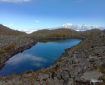
Trek to Sujal Sarovar via Panpatia Col – 10 Km – 8/10 hours. Camp. 4890 mtrs./16040 ft.
Day 12.
Trek to Kachni Khal and descent to Madmaheshwar – 12 Km – 9/10 hours. Lodge/camp. 3497 mtrs.
Day 13.
Trek from Madhmaheshwar to Ransi.– 16 Km – 5/6 hours. Drive to Chopta camp. 4 hrs. 2850 mtrs.
Day 14.
Mandatory buffer/reserve day (will be utilised, if required during the trek).
Day 15.
Drive to Rishikesh – 235 Km – 6/7 hours.